270
Street View & Aerial
Imagery API
Get street-level photos and aerial renders for any location through a simple REST API. No per-request billing. No rate limit surprises.
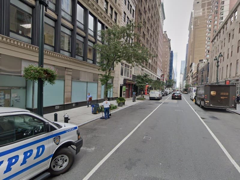
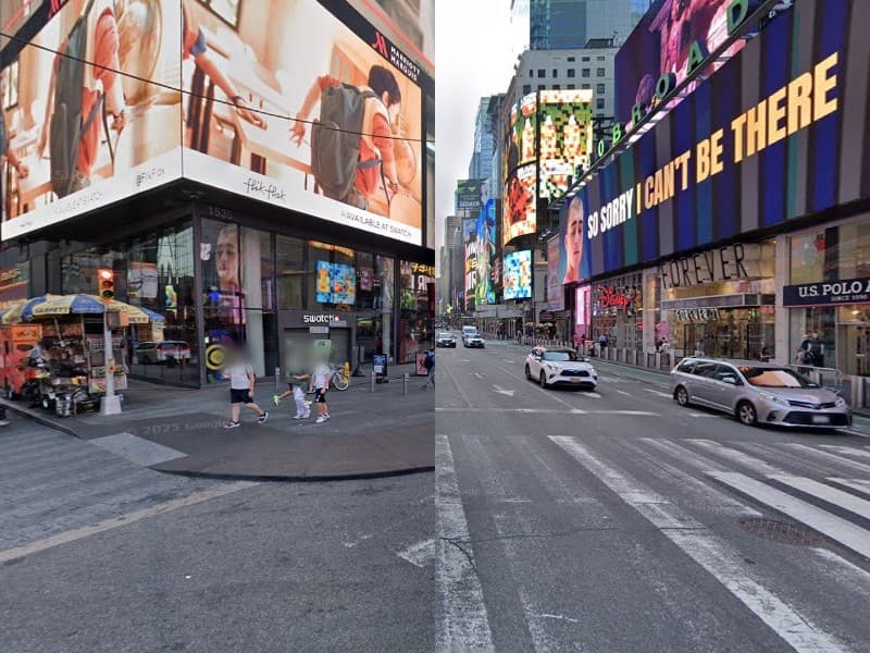
/api/v1/streetview?lat=40.7484&lng=-73.9857&heading=270Real API output
What you get
These images were generated by the gsnap API. One HTTP request, one image back.
Two APIs
Street-level imagery and aerial renders
Two complementary APIs for geo imagery. MapSnap (POI extraction) available as a secondary product.
StreetSnap
Street-level imageryRender street-level photos at any coordinate. Get metadata, panoramas, tiles, and coverage data. Drop-in compatible with the Street View Static API.
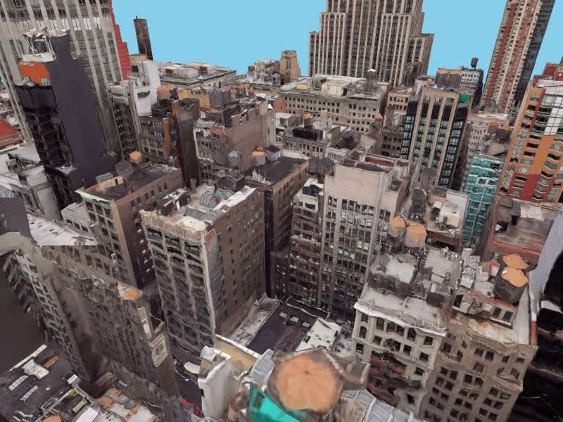
AerialSnap
Oblique aerial rendersRender aerial perspective views from 3D mesh data. Any heading, any tilt angle. Get oblique views of buildings, neighborhoods, and landmarks.
Simple integration
One curl, one image
Pass coordinates, get an image back. No SDK, no client library, no complex setup. Just HTTP.
Bearer token auth
JPEG/PNG/WebP output
JSON metadata with neighbor graph
Historical imagery (2009+)
# Get a street view image
curl -H "Authorization: Bearer $API_KEY" \
  "https://api.gsnap.dev/api/v1/streetview?lat=48.8584&lng=2.2945" \
  -o eiffel.jpg

# Get an aerial render
curl -H "Authorization: Bearer $API_KEY" \
  "https://api.gsnap.dev/api/v1/aerial?lat=40.7484&lng=-73.9857" \
  -o manhattan.png

# Get metadata (JSON)
curl "https://api.gsnap.dev/api/v1/metadata?lat=40.758&lng=-73.9855"Ready to get started?
Request an API key and start integrating street-level and aerial imagery today.